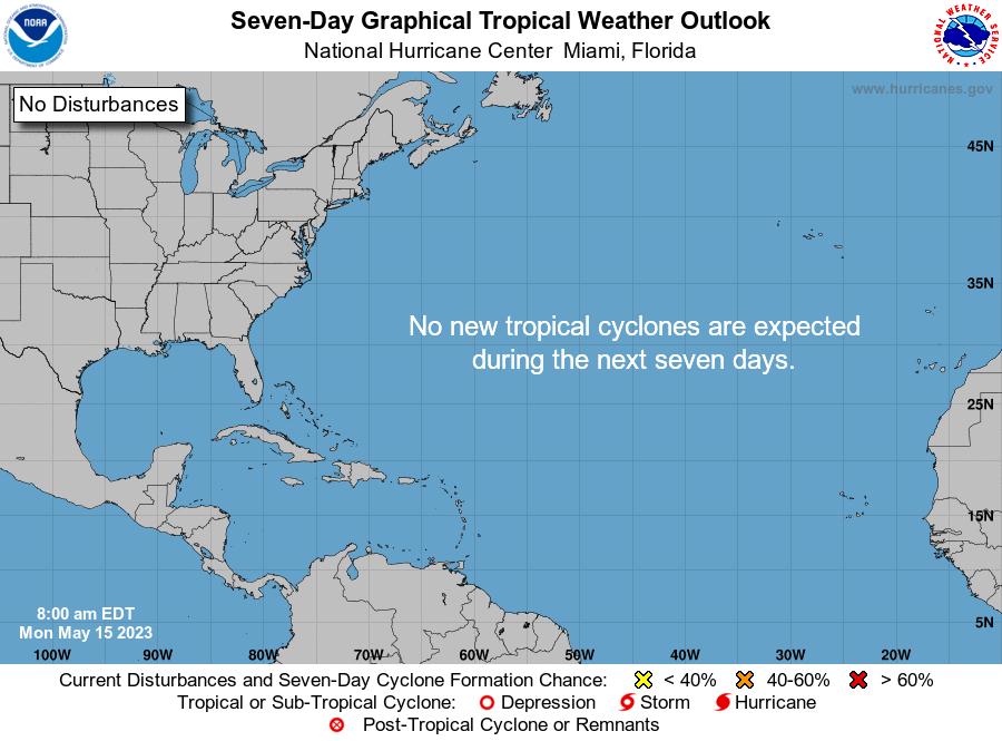
May 15th is the start of Hurricane Season in the Eastern Pacific, and the beginning of outlooks for us.
The outlooks basically show an area the National Hurricane Center (NHC) is watching for POSSIBLE development. They provide where the area is located, and the zone where it might organize, along with its chances for doing just that. This year the outlook goes out to 7 days, up from 5 on 2022.
Here are the names for 2023, and how they are pronounced

This is what NHC is saying on this 1st Day of the Tropical Outlook issuance
The Tropical Weather Outlook is issued from May 15 through
November 30 each year.  The issuance times of this product are 2
AM, 8 AM, 2 PM, and 8 PM EDT.  After the change to standard time
in November, the issuance times are 1 AM, 7 AM, 1 PM, and 7 PM EST.

A Special Tropical Weather Outlook will be issued to provide
updates, as necessary, in between the regularly scheduled issuances
of the Tropical Weather Outlook.  Special Tropical Weather Outlooks
will be issued under the same WMO and AWIPS headers as the regular
Tropical Weather Outlooks.
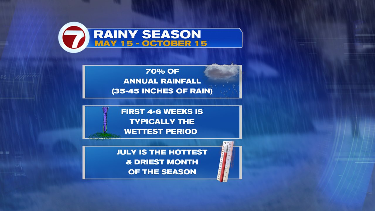
RAINY SEASONIt kicked off Monday and runs thru Mid October.


No comments:
Post a Comment