Sunday, July 13, 2025

Soggy Days Ahead

No one wants to hear about the possibility of heavy rainfall across South Florida, specially when our area deals with flooded streets and homes so often. Unfortunately, there is a threat for heavy downpours starting Sunday evening and sticking around through Tuesday.


SATELLITE LOOP


You can blame it in part, to this area of clouds and rain just off the SE Coast.  It is forecast to cross the state and emerge over the Gulf waters in the days ahead, pushing moisture in our direction. The National Hurricane Center (NHC), is also looking at this feature for possible organization.


WHERE MAY IT DEVELOP?


NHC THINKING
Environmental conditions could support some gradual development of this system during the middle to late part of this week while it moves westward over the northeastern and north-central portions of the Gulf.  


Regardless of development, heavy rainfall could produce localized flash flooding over portions of Florida and the north-central Gulf coast through the mid to late portion of this week. Presently it has a low chance for organization somewhere inside yellow area.

* Formation chance through 48 hours...low...near 0 percent.
* Formation chance through 7 days...low...20 percent.

WHAT NEXT?


Even without tropical genesis, as the low moves westward, it could keep the state under high probabilities for rainfall thru Tuesday, and maybe even longer.
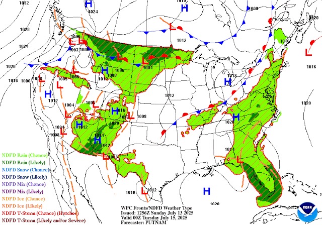
SOUTH FLORIDA RAIN
This low-to-be in the Atlantic, along with high pressure over the Gulf Waters, will conspire to keep our atmosphere unsettled which may lead to big bouts of rainfall.

NWSMiami suggests:
While there is a risk for a couple of marginally severe storms on
Sunday and Monday, the primary threat for this setup looks to be
periods of steady and heavy rainfall given an overall lack of
significant wind flow in the atmospheric column. 
  • This could lead to stagnant showers and storms as well as training convection, plus chances for cold pools and associated outflow boundaries tospark additional showers and storms over the same areas. 
  • Latest HREF LPMM pinpoints 3-5" or so over the interior sections of South Florida and 2-4" over portions of the east coast metro for Sunday. 
  • If these amounts occur in a short duration of time, localized flooding will be possible. 
  • With this in mind, the Weather Prediction Center (WPC) still maintains a marginal risk (level 1 of 4 and a general 5% chance of rainfall exceeding FFG) for excessive rainfall for the eastern half of the CWA. 
  • On Monday with the disturbance arriving and PWATs rising above the 90th percentile, WPC has a slight risk (level 2 of 4 and a general 15% chance of rainfall exceeding FFG) across all of South Florida.
The above data suggests possible pockets of heavy rain sitting over an area for prolonged periods of time.


BOTTOM LINE
As far as a Tropical Threat for South Florida at this time, the Worry Meter remains low. The potential for heavy rain however, is very high. 
Please stay tuned to WSVN, on-air & on-line for the latest.

Friday, July 4, 2025

Possible Tropical Activity near Florida

The National Hurricane Center (NHC) is monitoring a spin just off the NE Florida coast for possible development.


The actual spin, now area of low pressure, is roughy 100 miles East of Jacksonville, running alongside a decaying front. 

It has been deemed Invest 92L. Invest for an area NHC would like to INVESTigate further, 92 is a tracking number, and "L" stands for the Atlantic basin.

CHANCES FOR DEVELOPMENT


As of Friday morning, atmospheric conditions may support development of a depression late in the day or this weekend... that is, if the center spin can stay over water.  
  • There's a 60% chance for organization between now and the next 7 days. 
  • If it moves inland , then formation chances will drop.
  • A Recon mission is scheduled for later in the day to get a better handle on this system.

WHERE MAY IT GO?


Early model runs are not in agreement. While most show a system along the East Coast on a northward track, others keep it hovering over the SE. Heavy rain potential will be present.

SOUTH FL IMPACTS?


Even if Invest 92L does not turn tropical, the counterclockwise circulation will keep drawing moisture from the Gulf Waters leaving us rather soggy thru the weekend.

Per @NWSMiami
"Expect continuing 
rounds of showers and thunderstorms, with global models depicting 
widespread rain across SoFlo. High-res/CAMs keep rainfall totals in 
the 2-3" range through the weekend. Periods of heavy rain, 
especially with training of cells or terrain anchoring, may 
result in localized urban flooding. LPMM estimates show possible 
isolated accumulation values of up to 5 inches with the heaviest 
or long- lasting downpours. A few overnight showers or isolated 
thunderstorms can't be ruled out." 

The entire 7Weather team will keep you updated on this feature.  Regardless of the rain, we hope you have a safe and dry, 4th of July.

Tuesday, July 1, 2025

4th of July may brew Tropical Activity

The National Hurricane Center (NHC), is monitoring parts of Florida for possible tropical development over the next 7 days.


They suggest we could see an area of low pressure popping up somewhere inside the yellow area. They're giving that possibility a 40% chance of happening, up from 20% Monday.

A weak front will enter Northern Florida by the end of the week, and stall over the region. This usually allows for some spin-ups to happen in the atmosphere. These spins can then turn tropical.

MODELS


🔴 The ECMWF has an area of low pressure emerging near Florida's Big Bend on the fourth. The outlook suggests moisture swinging toward South Florida and allowing downpours to develop.


🔴 THE GFS also places a low near the same area, and here too calling for rain spreading into south Florida.

So far models are not providing any real tangible tracks for whatever may develop, if anything.

LONG RANGE


Beyond the 7 day outlook, NOAA's forecast keeps us on the quiet side of things thru the middle of the month.

CLIMATOLOGY


History shows us that most systems developing in July, tend to do so in the highlighted areas, with the green zone being the most active.

Since a low could develop over a favored site, we'll keep watching for additional observations and analyses to help us in determining what the forecast may be. For the moment, it appears as only summer rain for the Holiday weekend.

The worry meter remains low for the NW Bahamas, South Florida, and Cuba.

Monday, June 30, 2025

First Florida Tropical Concern for 2025?

The National Hurricane Center (NHC), is eyeing the possibility of some sort of tropical development possibly by the upcoming weekend.

WHERE MAY A SYSTEM DEVELOP?


NHC suggests that over the next 7 days, low pressure may develop inside the yellow area. They are giving this possibility, a low 20% probability of actually forming.

WHY?


This is a forecast map valid on Saturday July 5th. It shows a front moving into north Florida and stalling. 

When this happens, it usually has an area of low pressure developing in the Gulf Waters. 

If that does take place, then there may be a chance for some growth of the low.

SOUTH FLORIDA IMPACTS?

Uncertainty in the long term forecast stems from the possibility of a disturbance developing sometime later this week. Some of the deterministic guidance hints at an area of low pressure potentially forming somewhere along the stalled frontal boundary (could be over the Gulf waters, or over the Panhandle, or even over the Gulf Stream waters). 

However, the lack of model consensus or a consistent trend continues to complicate the forecast. If a system does develop, it could potentially help enhance the aforementioned chances for showers and thunderstorms across the region, and elevate the potential for severe and flooding impacts.

This scenario will need to be monitored closely in the coming days. COURTESY NWSMiami

RAIN CHANCES


Over the next 7 days, typical rain probabilities for South Florida range between 50% & 60%. Models suggest this is where we will be thru Friday. Long range into next weekend, keeps the chances on the low end of normal. 

We will have to monitor that as it may change depending on where the low actually develops, if at all.

NO tropical concerns for SE Florida, the Bahamas & Cuba at this moment. The worry meter is low.

If there is a change in the models, the entire 7Weather staff will keep you updated. This is a good reminder that we are hurricane season and we should be prepared in case Mother Nature spins anything our way.


Thursday, May 22, 2025

Official NOAA 2025 Seasonal Forecast

NOAA'S 2025 Hurricane Season Forecast

The National Oceanic & Atmospheric Administration (NOAA) made public their projections on Thursday, as to how active this coming season may be.

They're calling for:


  • 13 to 19 Named systems, out of which-
  • 6 to 10, could turn into hurricanes, and out of this number -
  • 3 to 5 may be stronger than a category 3

What are the factors for this? El Niño-Southern Oscillation (ENSO), sea surface temperatures (SST), and atmospheric conditions. 


Warmer water temperatures. Tropical systems need 80 degrees of water temps to develop. The models suggest higher ocean temps this season.

Strong Upper winds known as shear, will NOT be that plentiful. These winds can keep storms from developing or growing stronger

El Niño, which is an above average warming of the Pacific Ocean and helps keep the atmosphere hostile to hurricanes, will NOT be present

Additional moisture out of Africa could provide another ingredient for systems to form

As always follow myself, and the entire weather team On-Air and on-line for the latest happenings in the Tropics.


Soggy Days Ahead

No one wants to hear about the possibility of heavy rainfall across South Florida, specially when our area deals with flooded streets and ho...