Satellite

You can clearly see a center spin. The cloud bands are setting up the classic "tropical system" look.
As it travels over warmer than usual waters, it is poised to gain strength. We will be monitoring if any shear, or strong upper winds, will lay in its path hopefully to weaken it.
Where is it?
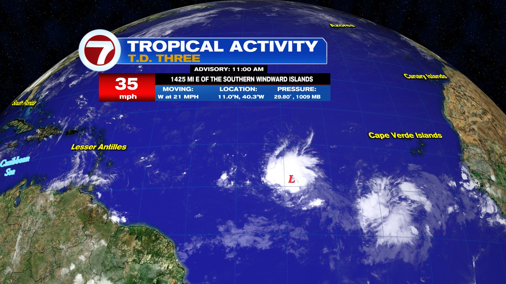
- Location: Roughly 1400 miles East of the Southern Windward Islands.
- Winds: As of this update- 35 mph
- Moving: W at 21 mph
- Pressure: 1009 mb / 29.80"
Where is it going?
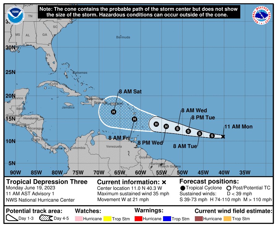
The official forecast cone shows where the center of the system may be over the next 5 days. A reminder to our Caribbean neighbors that impacts from the system will be felt outside the cone so please plan accordingly.
Tropical Depression 3 is forecast to become Tropical storm Bret by Tuesday. Per Dr. Phil Klotzbach of CSU, this would make the 2nd earliest calendar year formation of a tropical storm in the tropical Atlantic on record, trailing Bret (2017)- named on 6/19 at 18 UTC
Models
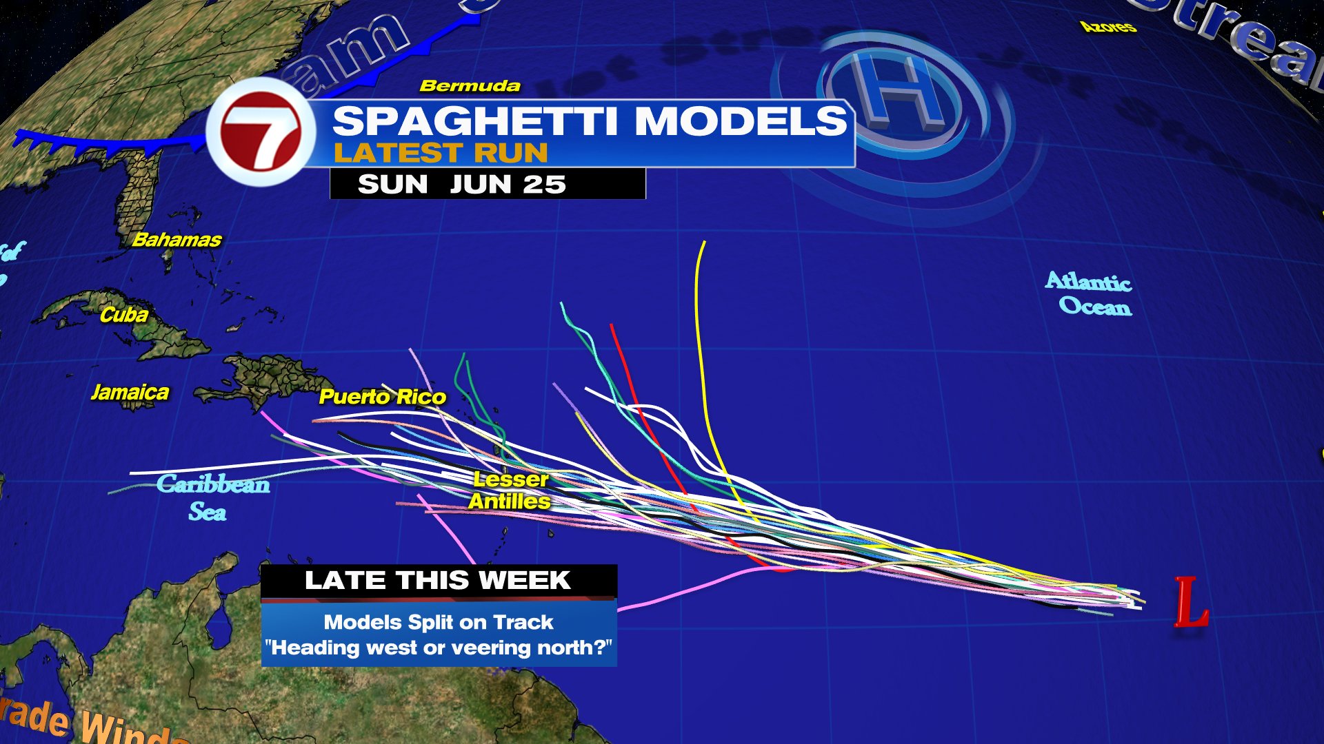
Here's the latest suite of spaghetti models. They're used to generate the forecast cone. While there appears to be a large spread as it nears the islands, more and more models are showing a direct path to the Lesser Antilles.
Worry Meter
Lesser Antilles: High. Possible heavy rain, rough surf, and gusty winds. As the system gets closer, it is forecast to turn into a hurricane. You should prepare now as needed. Follow your local authorities instructions.
Caribbean: Medium. Keep an eye on the depression. If it intensifies more, it will be feeding off very warm Caribbean Sea waters. This could increase the impacts from the storm. Stay alert prepare now.
Another area NHC is monitoring

This is right on the heels of tropical depression 3. It has now been deemed Invest 93L.
Latest NHC Outlook says
Showers and thunderstorms have increased in association with a tropical wave located several hundred miles south-southwest of the
Cabo Verde Islands.
Further development of this system is
possible, and a tropical depression could form within the next few days while the system moves westward at 10 to 15 mph across the eastern and central tropical Atlantic.
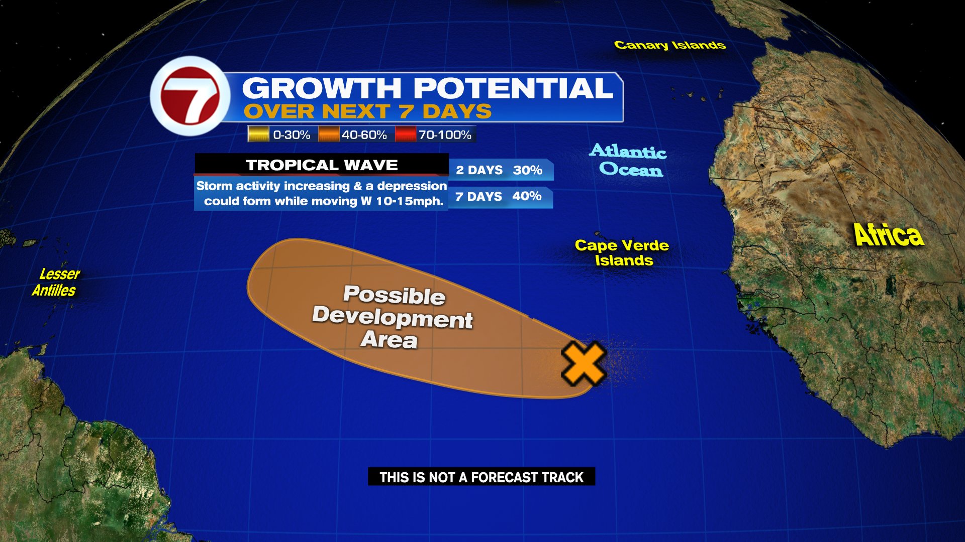
It has a 40% chance for development in orange area over a period of 7 days.
We'll be watching


You bet. Thank you for following.
ReplyDelete